Log in
All resources
Create a design
39,603 Free Images of 1905 Maps
maps in the library of congress
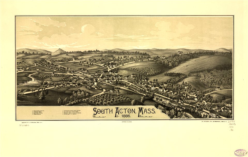
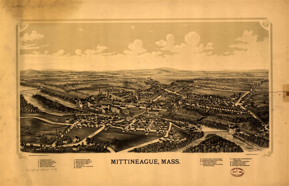
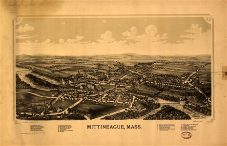
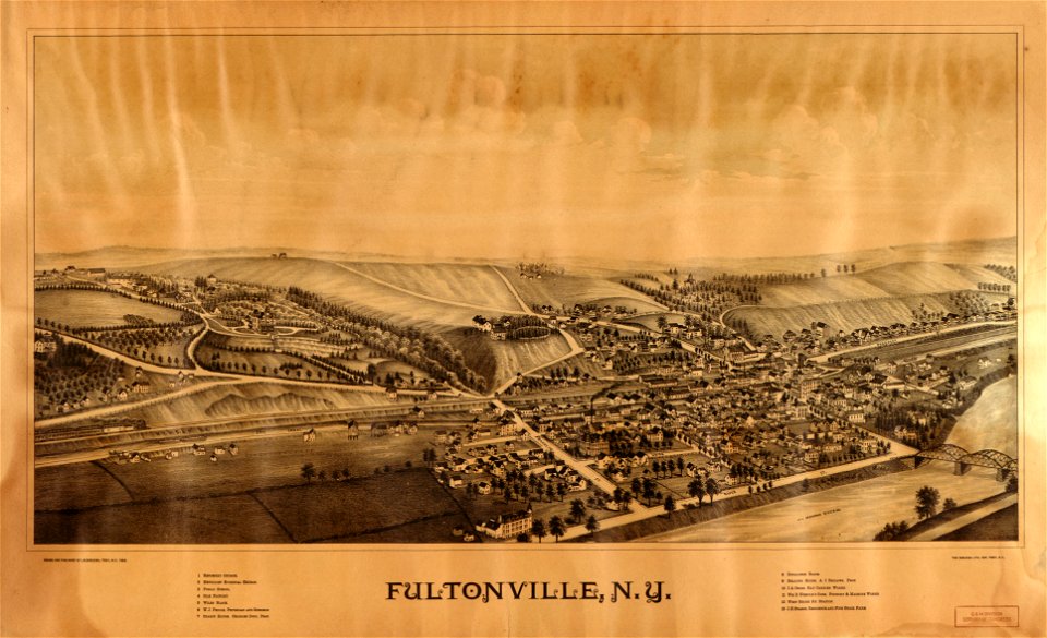
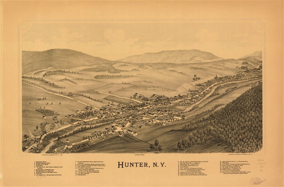
town maps by l. r. burleigh
massachusetts
new york
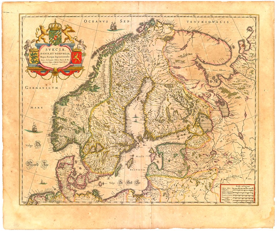
maps made in the 17th century
maps with cartouches
o. h. bailey
atlas van der hagen
l. r. burleigh
maps by pieter schenk (i)
1590 maps
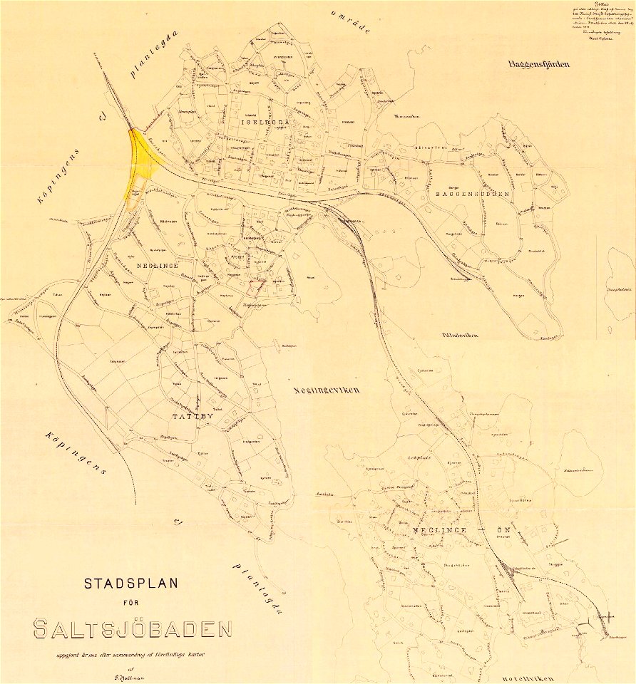
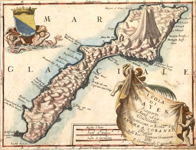
saltsjöbaden
maps
1841 maps
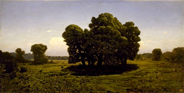
paintings by arkhip kuindzhi in the russian museum
landscape paintings by arkhip kuindzhi
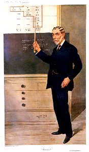
william ramsay
leslie ward
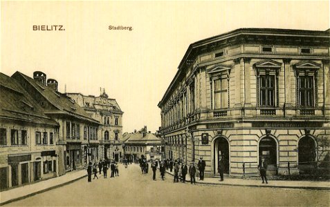
1905 postcards of poland
meißen
caricatures by leslie ward in vanity fair
vanity fair caricatures (politicians)
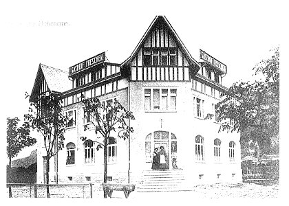
postcards of buildings in austria
postcards of vorarlberg
still life paintings by pierre-auguste renoir
1905 paintings by pierre-auguste renoir
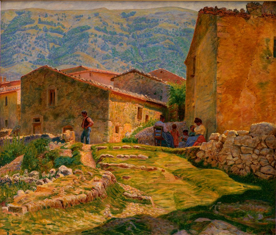
paintings of italy by kristian zahrtmann
civita d'antino in art
feathered headdresses in art (female)
men and women in art
original art works by mariano pedrero
madrid in art
1958 deaths
1867
genre painting
tea party
black and white reproductions of 15th-century portrait paintings of men in color
fierens-gevaert
historical coats of arms of denmark
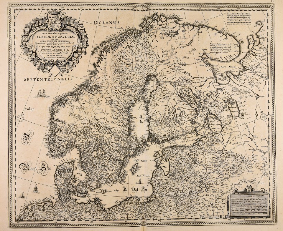
royal coats of arms of sweden
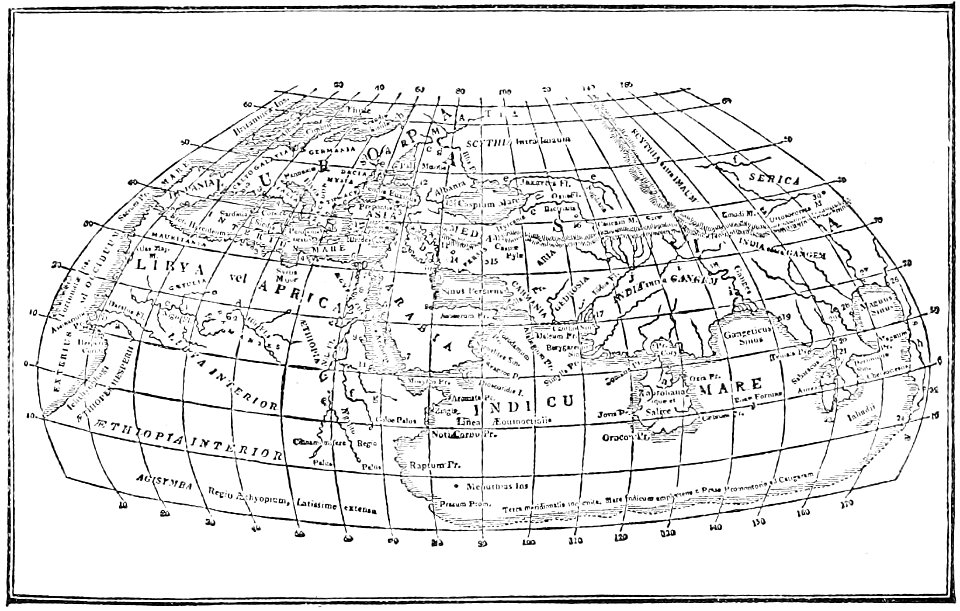
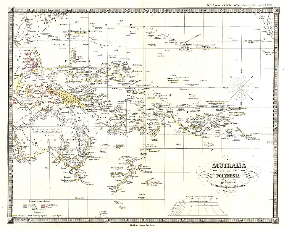
1870s maps of the world
latin-language maps
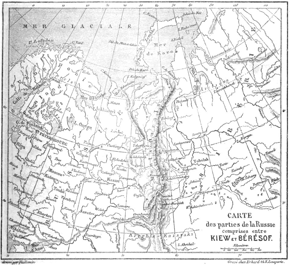
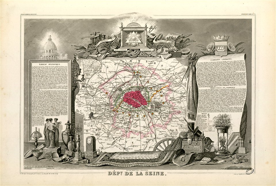
volume 6 of le tour du monde
maps by alexandre vuillemin
maps in the library of congress
massachusetts
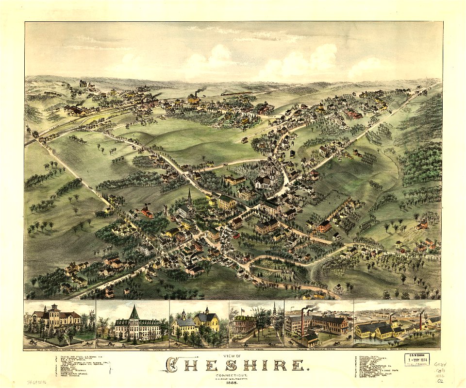
connecticut
cheshire
connecticut
cheshire
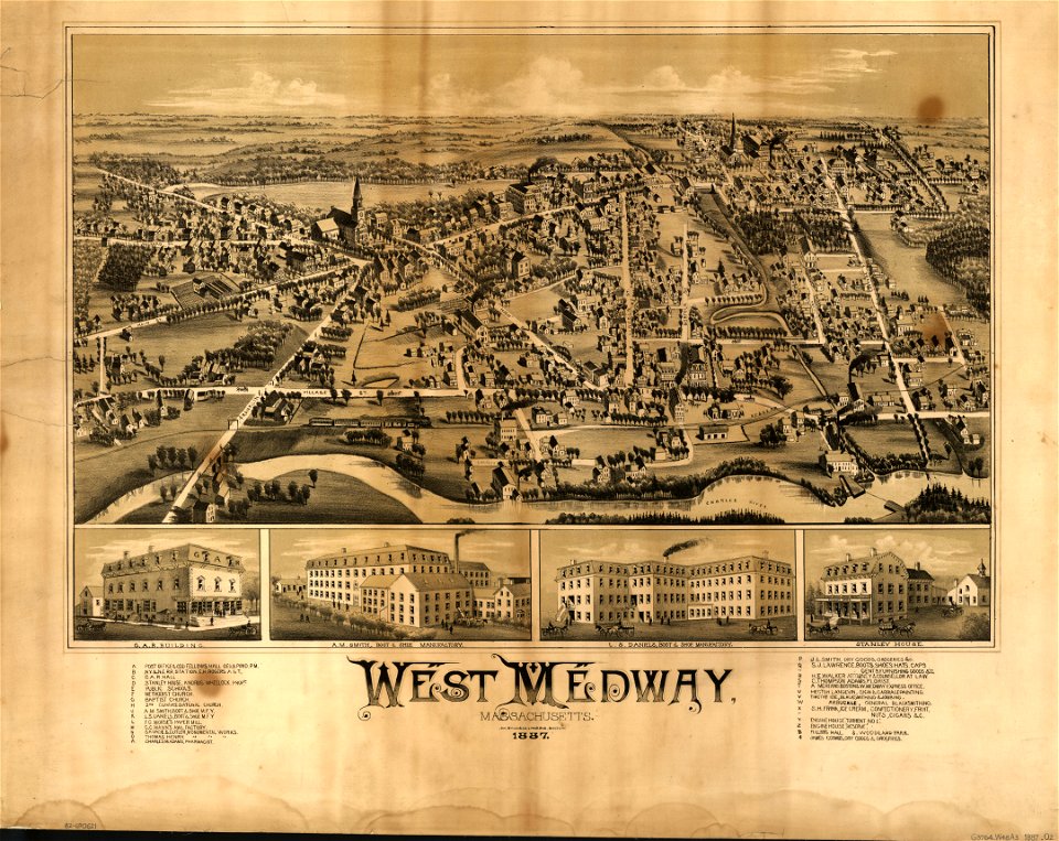
old maps of massachusetts
o. h. bailey
old maps of massachusetts
o. h. bailey
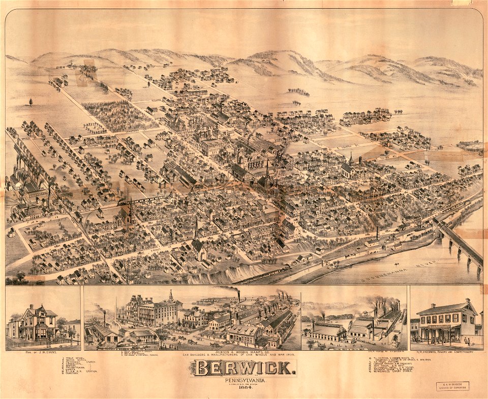
pennsylvania
berwick
pennsylvania
berwick
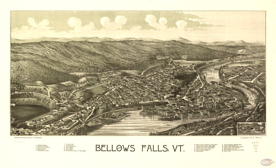
maps in the library of congress
vermont
maps in the library of congress
vermont
atlante veneto (raremaps.com) volume 2
bermuda
new york
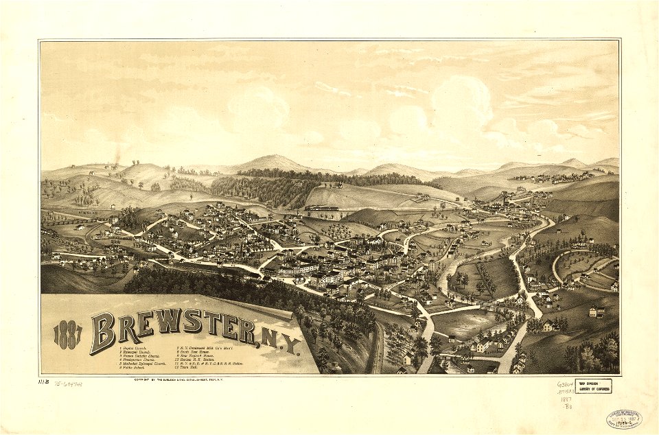
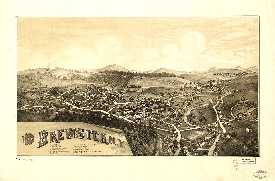
brewster
new york
brewster
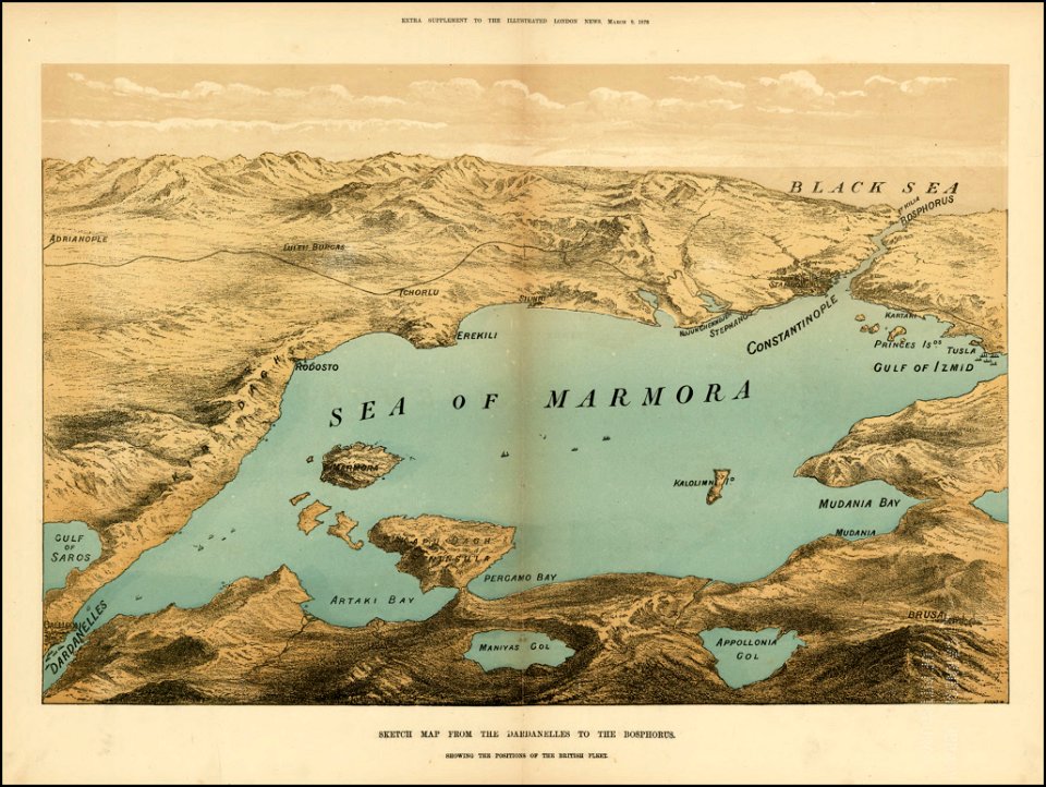
the illustrated london news 1878
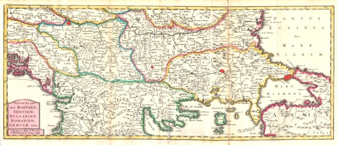
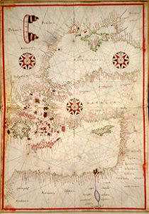
maps of the sea of marmara
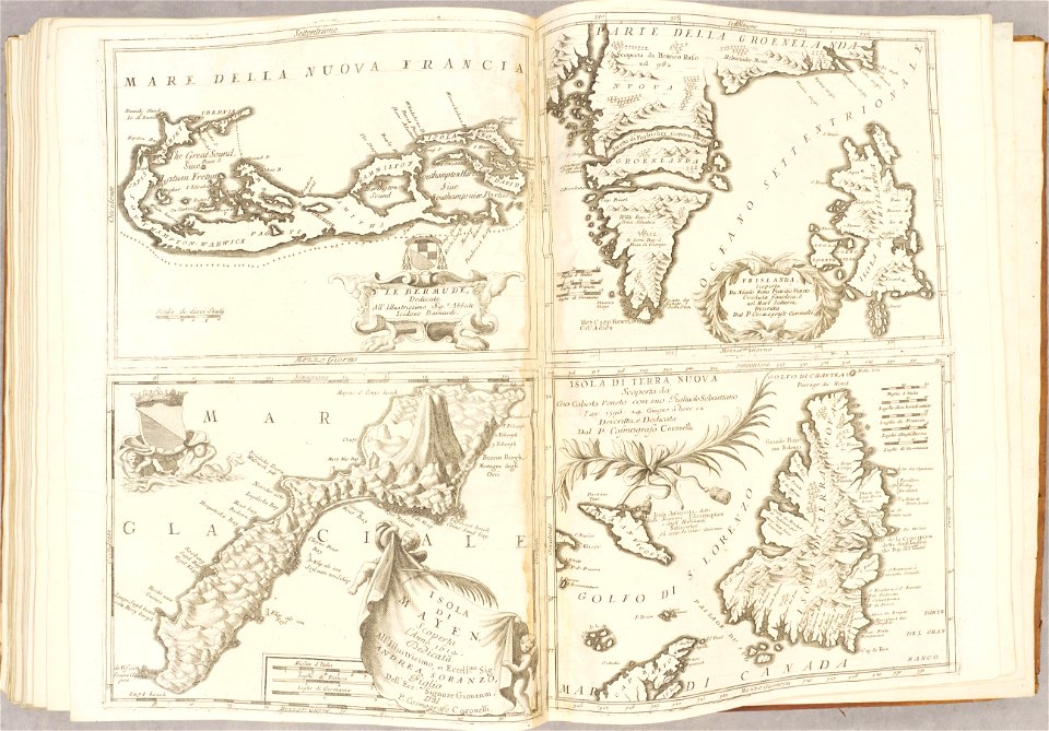
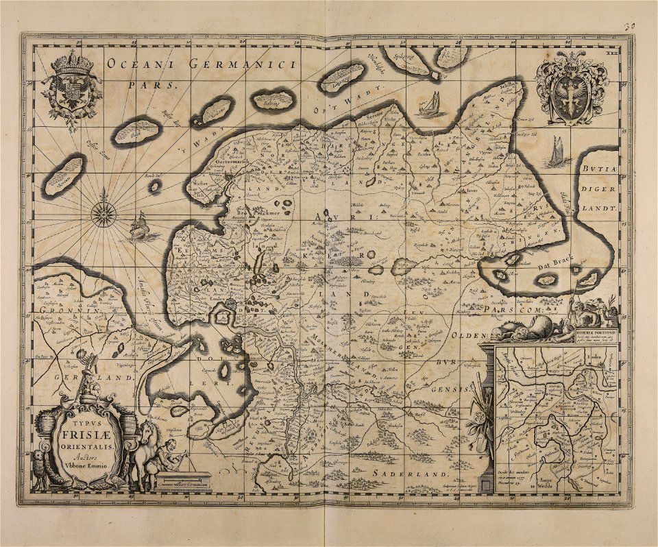
maps made in the 17th century
old maps of gdańsk
maps with cartouches
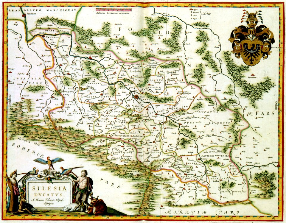
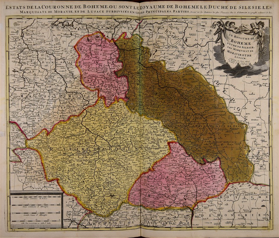
old maps of silesia
maps with cartouches
atlas van der hagen
maps with cartouches
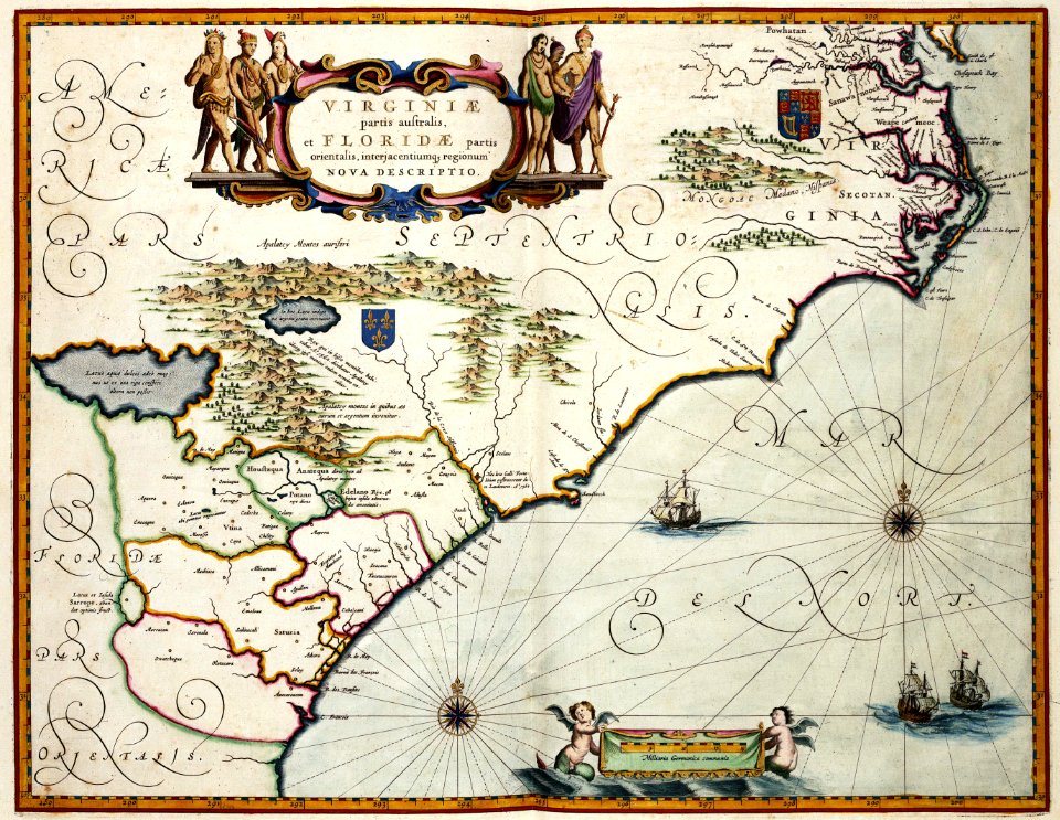
maps of virginia
maps with cartouches
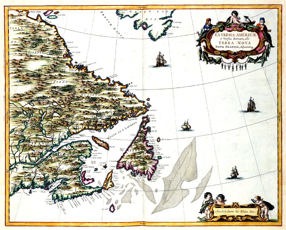
old maps of canada
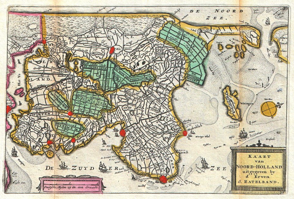
old maps of north holland
johannes ratelband
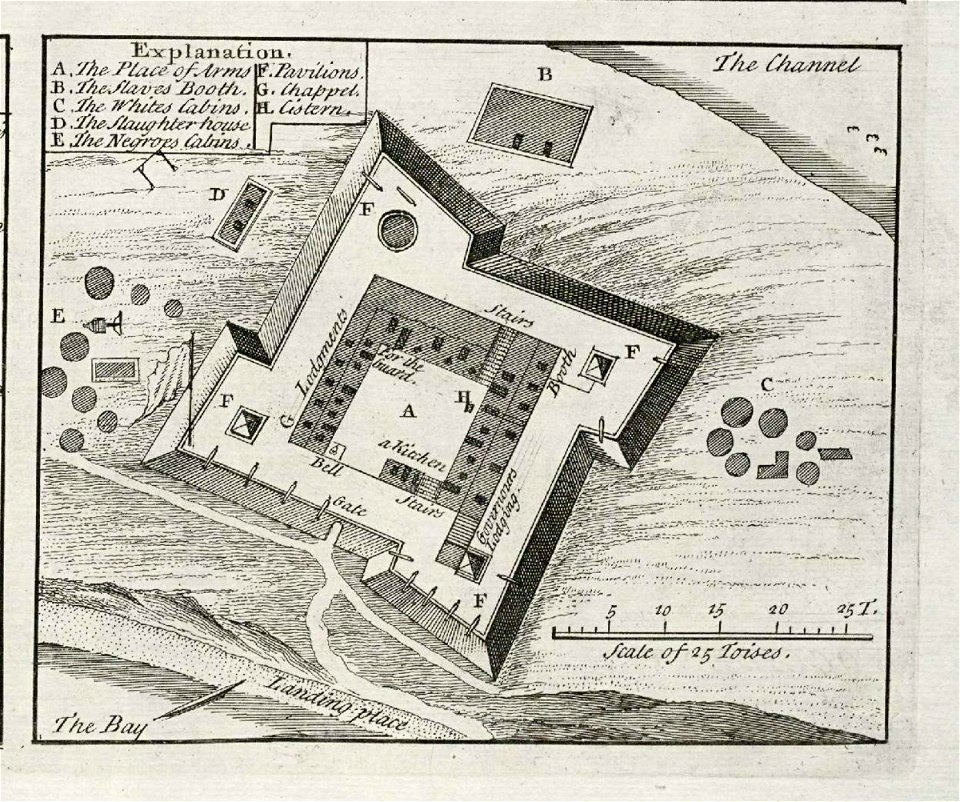
joseph james forrester
port wine
musée historique du sénégal
senegal
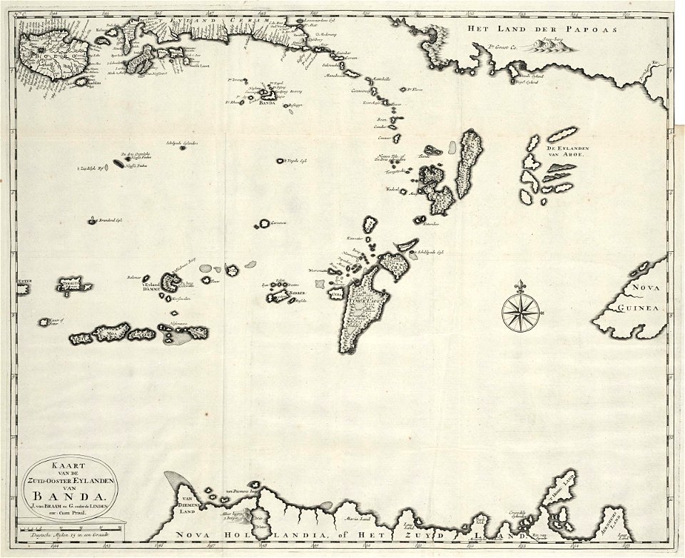
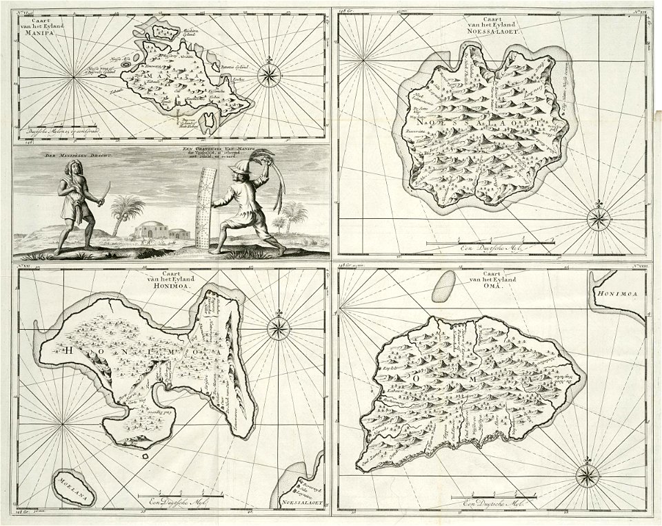
18th-century maps of indonesia
1724
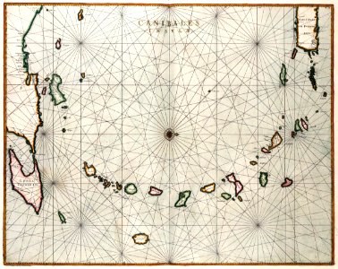
maps of the west-indische compagnie
1647
eastern province
sri lanka
18th-century maps of indonesia
1724
maps by willem and johannes blaeu
1662
pillars of hercules in heraldry
old maps of holland
maps with cartouches
1606 maps
fonds ancely - bibliothèque municipale de toulouse - maps
pierre gorse
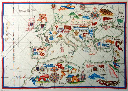
old maps of europe
diogo homem
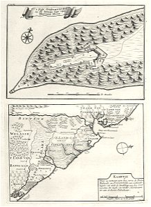
artwork by charles heaphy
old maps of new zealand
drawings in the universitätsbibliothek salzburg
historical images of dieppe
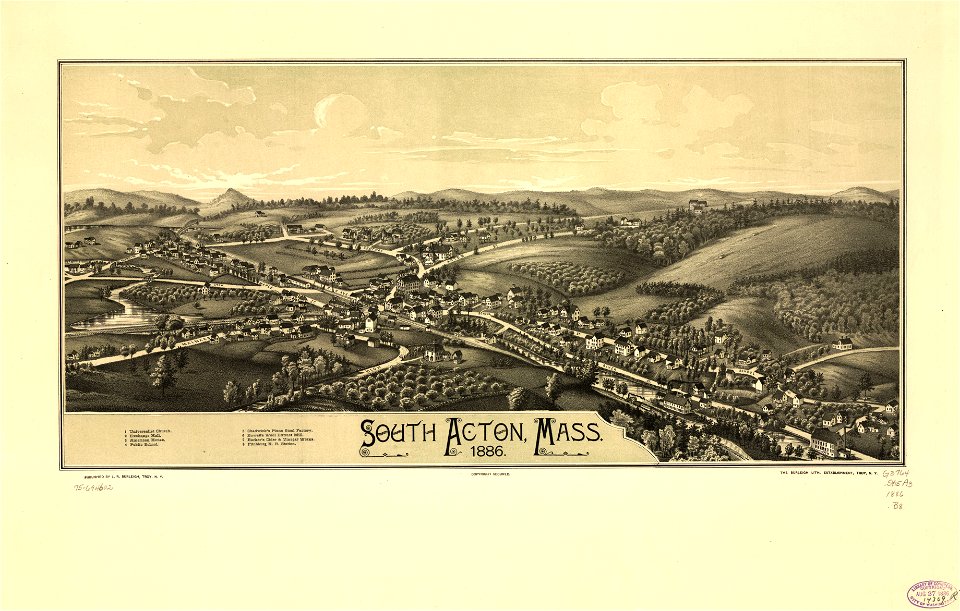
maps in the library of congress
massachusetts
description of kingdom of georgia
its habits and canons
maps in the library of congress
massachusetts
maps in the library of congress
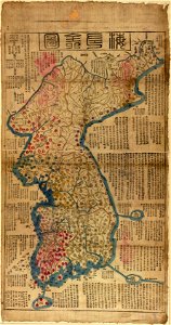
old maps of korea
maps in the library of congress
new york
latin-language maps
1628 maps
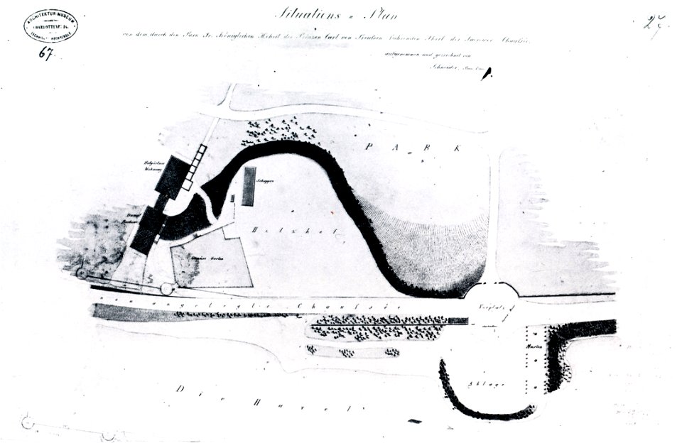
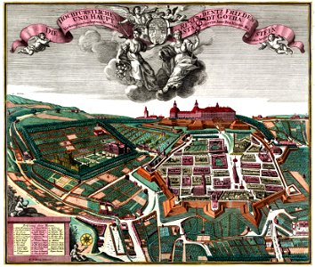
schloss friedenstein (gotha)
18th-century engravings
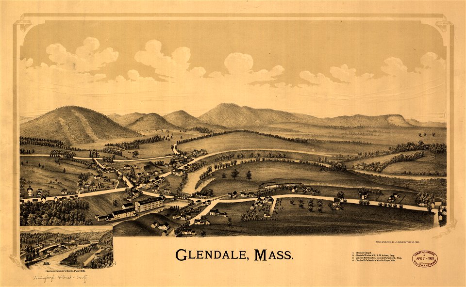
massachusetts
glendale,
old maps of massachusetts
massachusetts
maps of the first opium war
old maps of nanjing
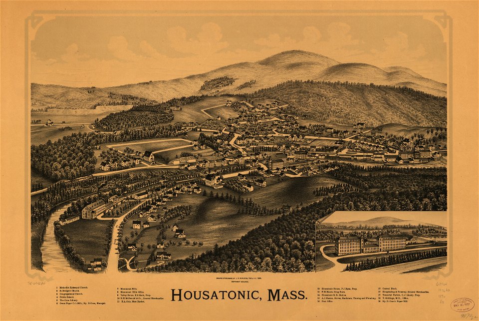
massachusetts
housatonic
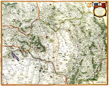
bibliothèque municipale de reims
maps relating to celts
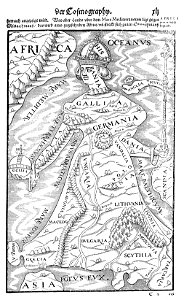
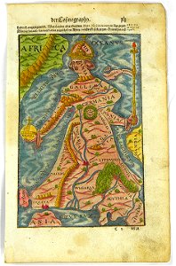
illustrations of cosmographia (münster)
latin-language maps
new york
rome
maps by willem and johannes blaeu
old maps of rotterdam
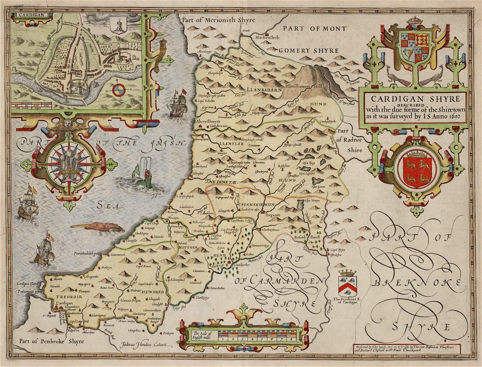
maps in the national library of wales
old county maps of cardiganshire
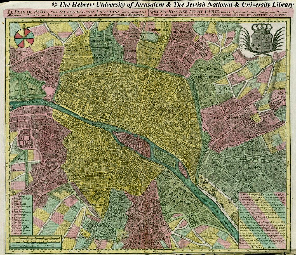
maps by matthäus seutter
copyfraud
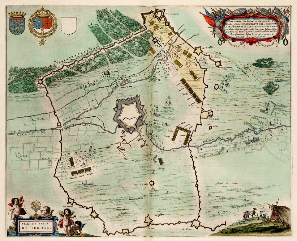
maps of hesdin city walls
circumvallation
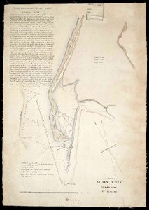
maps in the library of congress
massachusetts
volume 7 of le tour du monde
1860s maps of palestine
party per bend or and azure
coats of arms on maps
nicolaes visscher ii
abraham goos
old maps of manhattan
new york city
maps of the ottoman empire in the 19th century
maps by joseph hutchins colton
old maps of australia
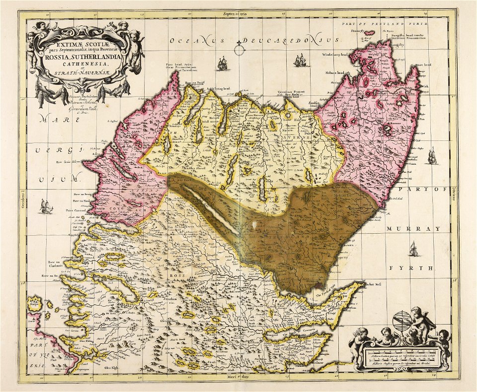
karl spruner von merz
maps with cartouches
atlas van der hagen
maps in the rijksmuseum amsterdam
sloten (amsterdam)
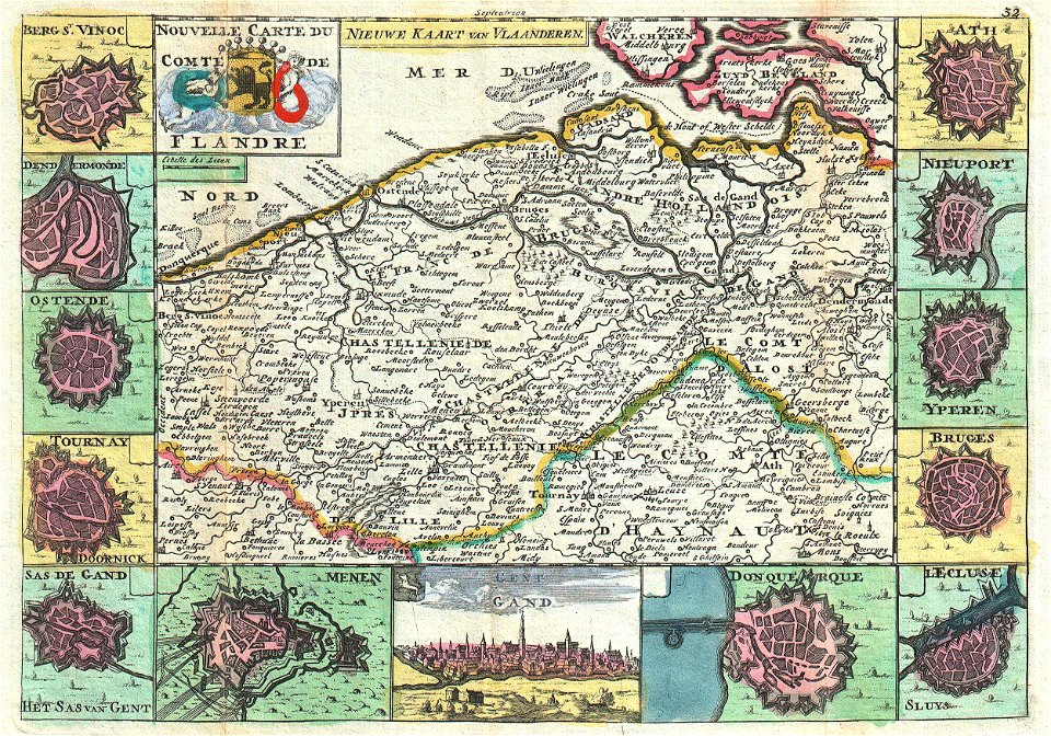
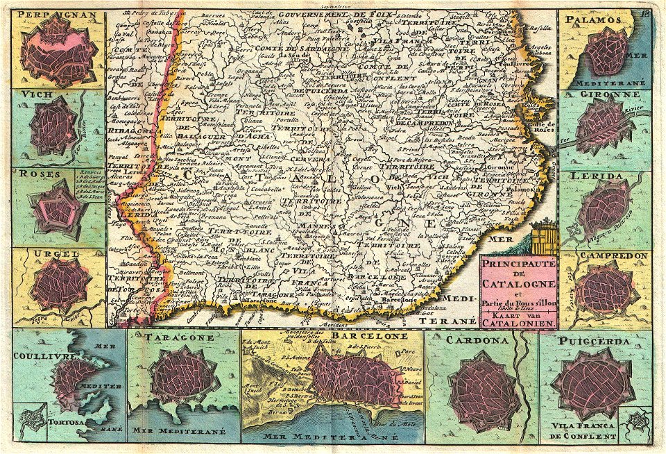
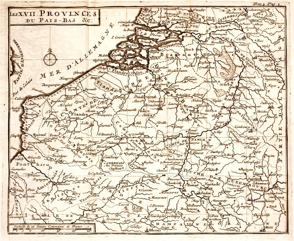
maps of the county of flanders
johannes ratelband
french-language maps
johannes ratelband
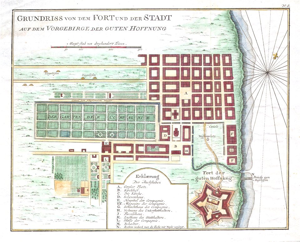
history of cape town
german-language maps
old maps of the dutch east india company
1757 maps
kingdom of serbia (1718–1739)
maps of the sea of marmara
frédéric-auguste laguillermie
molière
description of kingdom of georgia
its habits and canons
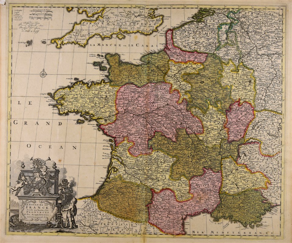
maps made in the 17th century
maps by nicolas sanson
maps made in the 17th century
maps by nicolas sanson
maps in the library of congress
new york
maps made in the 17th century
1700 maps of lithuania
1700s maps of belgium
old maps of lorraine
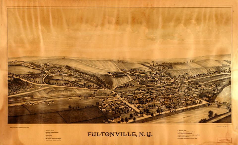
new york
hunter
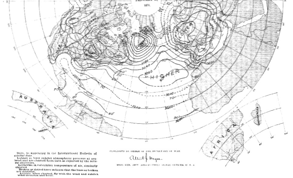
old weather and climate maps
1880 maps
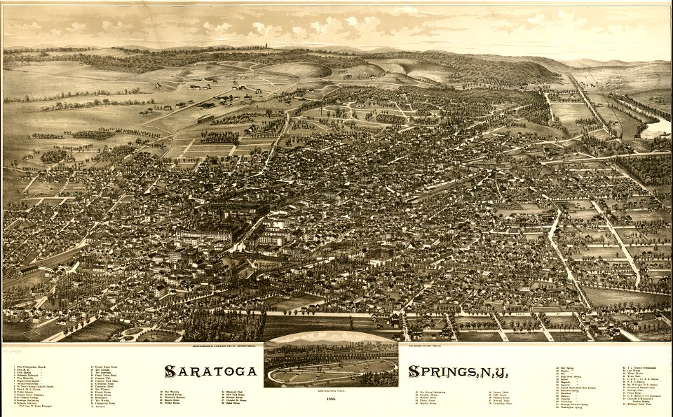
saratoga springs
new york
maps made in the 18th century
old maps of europe
maps made in the 17th century
old maps of trentino
maps made in the 17th century
maps by johannes janssonius
itinerario (jan huygen van linschoten)
latin-language maps
pictorial maps
barbados
maps with cartouches
maps of reims
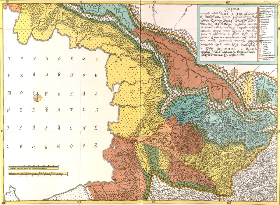
16th-century maps of the black sea
maps in the library of congress
maps made in the 17th century
gerard valck
4701 - 4800 of 39,603
Next page
/ 397